Import & Segment 3D Grayscale Images
ImportGeo-Vol
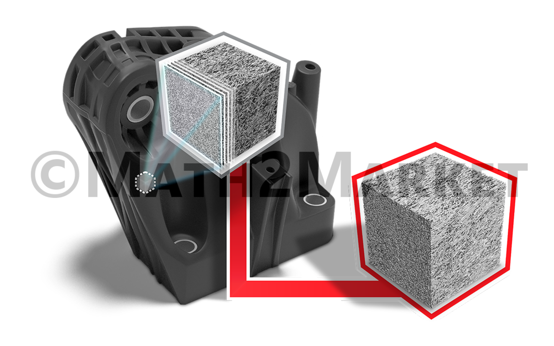
The module ImportGeo-Vol is used to import three-dimensional images of real objects and prepare them for further analysis in the GeoDict software.
In the ImportGeo-Vol process, images captured through various techniques (such as microcomputed tomography or FIB/SEM) are imported, qualitatively improved through image-processing steps, and then segmented. ImportGeo-Vol creates three-dimensional geometric models, which are well-suited to perform simulations, characterization and modelling on them.
In the image processing workflow with ImportGeo-Vol, the only limiting factor for the size of the data set is the working memory. Large data need a lot of memory. If this is given e.g. by using the GeoDict Cloud or another cloud solution, GeoDict can implement the image processing smoothly.


Import of diverse image formats
With the ImportGeo-Vol interface, in addition to the widely used three-dimensional image formats:
*.raw (generisches 3D field image file),
*.vol (generisches 3D field image file),
*.vgi (Volume Graphics),
*.rek (Fraunhofer EZRT volume data),
*.am (Avizo binary file)
also images such as:
* 8-Bit images in various image formats (*.png, *.tif, *.bmp, *.gif, *.jpg, ...) oder
* 16-Bit grayscale value-images (*.tif)
can be imported into the GeoDict software.
Image filter to improve the quality of the image
The imported images can be processed by the powerful image filters in GeoDict:
- Alignment filter
- Noise filter
- Sharpening filter
- Blur filter
- Artifact filters (streak and ring artifacts)
- Curtaining filter
- Watershed
- Python interface to implement your own image filters
Segmentation with ImportGeo-Vol
Any segmentation is only good to the extent that it digitally represents the actual material. Since there is no uniform metric or metrics by which to measure the quality of a segmentation, it is then also difficult to determine how representative the obtained digital twin ultimately is. GeoDict can remedy this situation:
- Manual threshold input
- Otsu method for automated segmentation of one or more materials
- KMeans method for automated segmentation of one or more materials
- AI-segmentation filter, based on labeling of materials


Additional GeoDict modules needed?
- The GeoDict Base package is needed for basic functionality.
- ImportGeo-Vol is functionally independent from other GeoDict modules but, since it imports structure models, is valuable in combination with GeoDict modules for digital Material Analysis.
- For the import of CAD file formats we recommend ImportGeo-CAD.